GeoStorylines
Geo-Storylines is a collection of visualisation designs that integrate geospatial context into Storyline visualizations, using different strategies for compositing time and space.
Their conception, associated design space and evaluation are detailed in the IEEVIS'22 publication:
[DOI] [PDF from HAL] [Pre-registration] [Sup. Material]The source code can be found here:
[gitlab @ Inria]You can test the three selected designs from the design space:
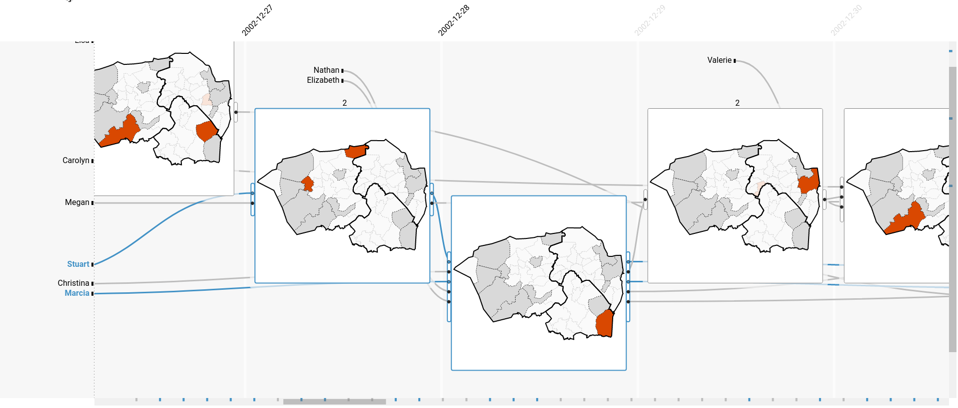
1.- Map Glyphs [demo]
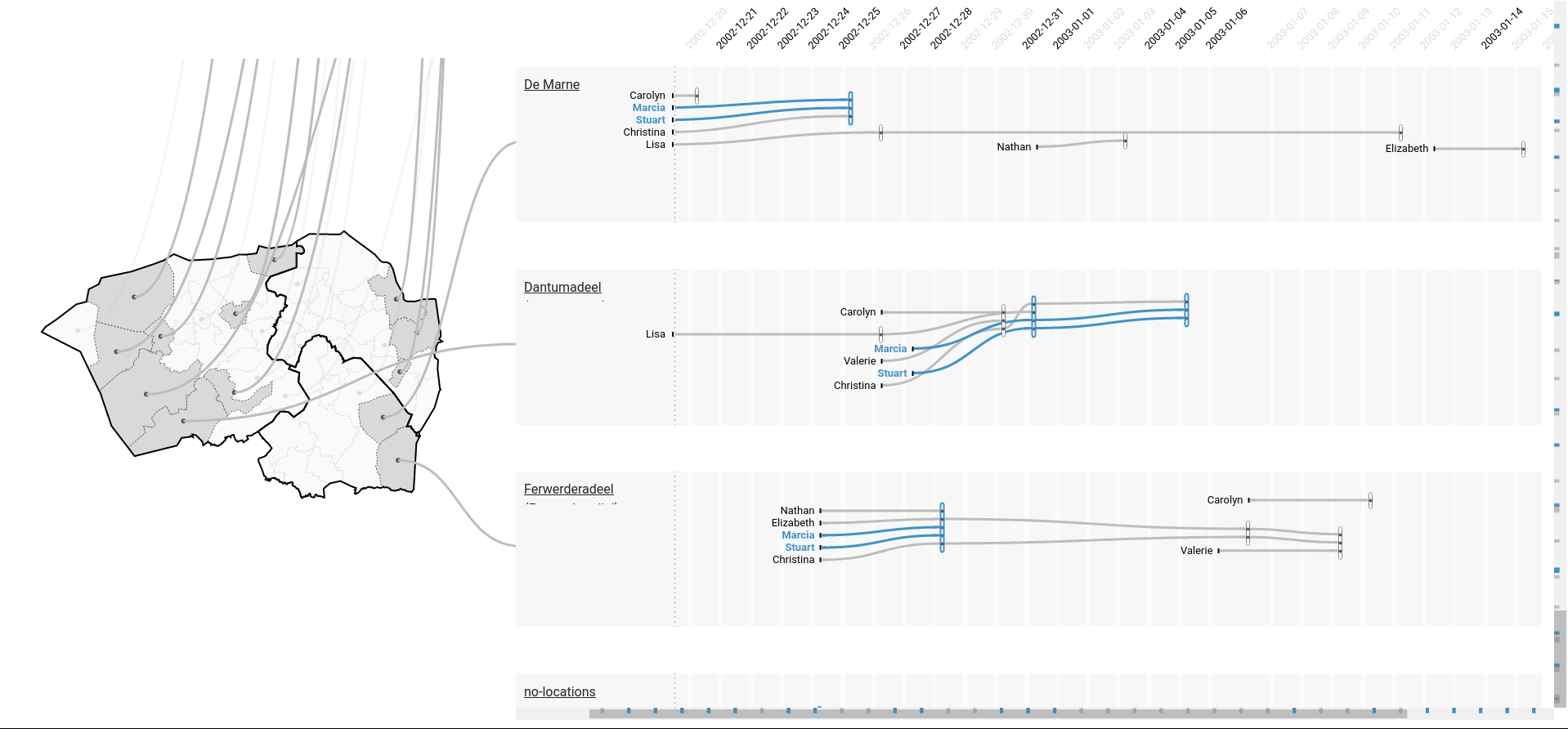
2.- Coordinated Views [demo]
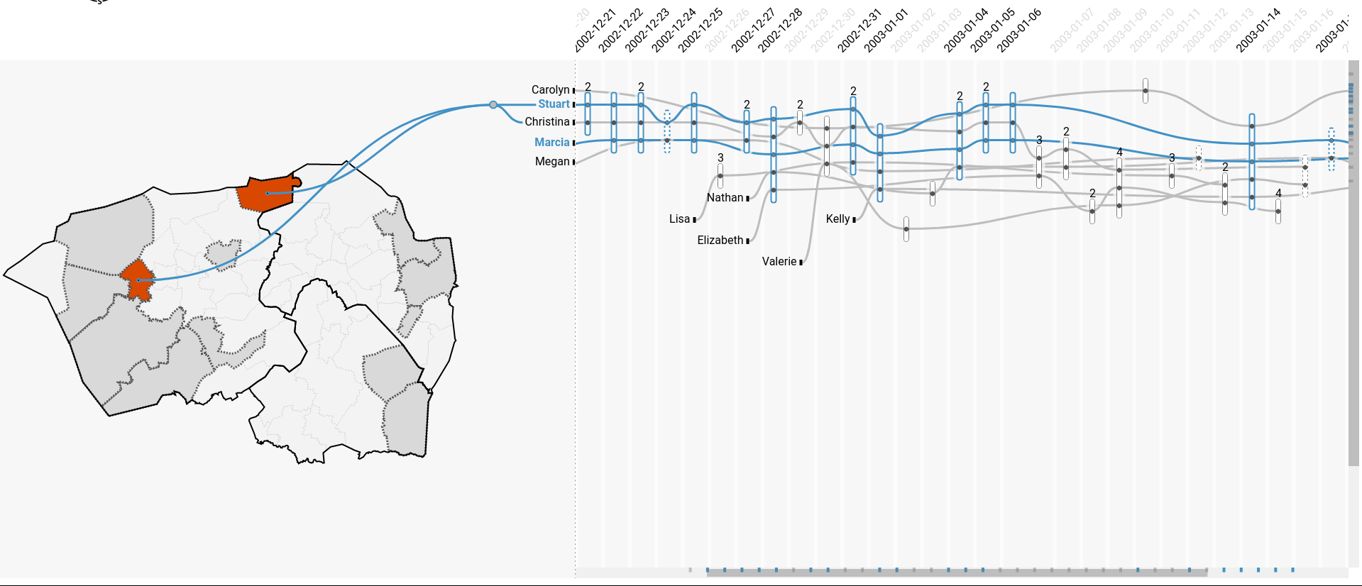
3.- Time Glyphs [demo]